Level: Intermediate
Length: 535 mi (861 km)
Surface: Singletrack
Configuration: Out & Back
Elevation: +23,055/24 ft
Total: 288 riders
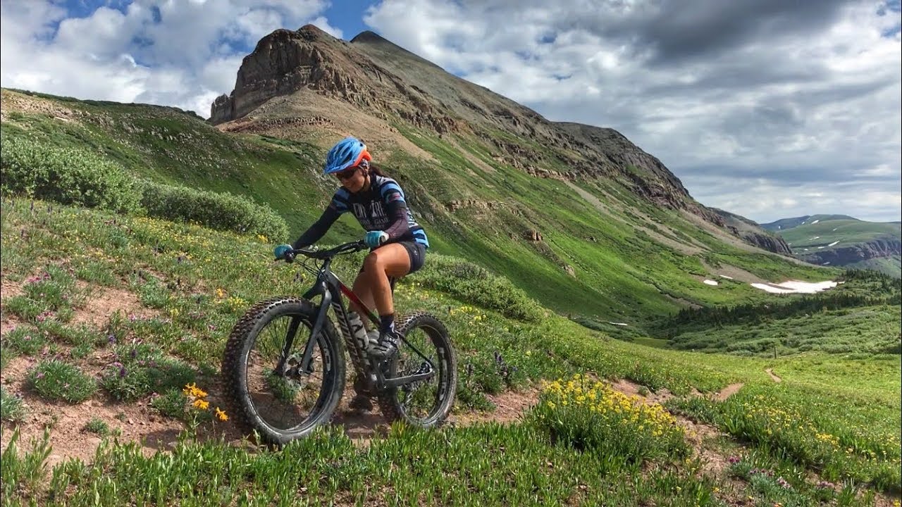
Mountain Biking Colorado Trail
#3 of 1,345 mountain bike trails in Colorado
#5 in the world
Amazing singletrack, killer views, and lung busting elevation - what more could you ask for? Portions of the Colorado Trail are off limits to bikes so you'll need to detour around each of the 6 designated wilderness areas. Many day trip routes are available and connecting trails abound.
First added by Jeff Barber on Aug 19, 2010. Last updated Jan 7, 2022. → add an update
Before you go
- Drinking water: unknown
- Lift service: unknown
- Night riding: yes

- Pump track: unknown
- Restrooms: unknown
- Fat bike grooming: unknown
- E-bikes allowed: unknown
- Fee required: unknown

This trail information is user-generated. Help improve this information by suggesting a correction.
Multiple trailheads around the state, click one of the individual segment listings above to get directions to a particular staring point. From Denver, start off S. Platte Canyon Rd.
System trails (28)
- Colorado Trail: Bolam Pass To Hotel Draw
- Colorado Trail: Buffalo Creek To Lost Creek Wilderness Boundary
- Colorado Trail: Clear Creek Thd to Collegiate Peaks Wilderness
- Colorado Trail: Clear Creek Thd to Lake View CG / Hwy 82
- Colorado Trail: Fooses Creek
- Colorado Trail: Green Mountain
- Colorado Trail: Hwy 114 to Cochetpa Pass Road / #750
- Colorado Trail: Hwy 149 to Silverton
- Colorado Trail: Hwy 50 to Marshall Pass
- Colorado Trail: Hwy 50 to Mt. Shavano Trailhead
- Colorado Trail: Kennebec Pass To Junction Creek
- Colorado Trail: Kenosha Pass To Breckenridge
- Colorado Trail: Kenosha Pass To Lost Creek Wilderness Bound
- Colorado Trail: Marshall Pass to Sargents Mesa / Rd #855
- Colorado Trail: Molas Pass To Bolam Pass Rd.
- Colorado Trail: Morrison Creek / Lunar Loop
- Colorado Trail: Mount Princeton to Avalanche Trailhead / Collegiate Peaks Wilderness
- Colorado Trail: Mt. Shavano thd to Chalk Creek thd
- Colorado Trail: North Cottonwood to Collegiate Peaks Wilderness
- Colorado Trail: North Cottonwood to Harvard Lakes
- Colorado Trail: Redskin Mountain
- Colorado Trail: Sargents Mesa to Hwy 114
- Colorado Trail: Searle Pass and Kokomo Pass (Copper Mountain to Camp Hale)
- Colorado Trail: Ski Cooper (Tennessee Pass) to Camp Hale
- Colorado Trail: South Platte To Buffalo Creek
- Colorado Trail: Tennessee Pass to Holy Cross Wilderness
- Colorado Trail: Twin Lakes / Hwy 82 to Half Moon Rd / Mount Massive Wilderness
- Colorado Trail: Waterton To South Platte
Featured in


Officially, most of this ride is Segment 3 of the Colorado Trail (Little Scraggy Trailhead to FS Road 560).
| ThankA demanding trail at elevation with over 3400' of climbing, an average grade of 6% and a maximum grade of 35% (as you approach the 9 mile marker). It is also part of the Continental Divide Trail and a major portion of the legendary Monarch Crest Ride.
| ThankThis is a true epic ride, yes in the Monarch Crest league. Absolutely brutal day of climbing, but the best down hill section of any of the epic trails I've ridden in Colorado. Scenery is stunning, trail is amazing, this is a must ride! The trail that they added at the 20mi mark is a brutal sustained climb that would take a special breed to clean, but the down hill afterwards is spectacular. Might be my new favorite trail in Colorado. Lots of water and food!
| ThankGreat trail. A little climbing a little technical and beautiful views
| ThankI did the entire trail from Silverton to Durango on a bikepacking trip. CT is an epic trail with monster hike a bikes and beautiful views.
| ThankRode out and back, starting from the South Platte THD. It is certainly a rigorous climb the first mile and really the first 5 miles. A very good workout. After you cross the dirt road (Raleigh Peak Road) at about 6 miles heading west, the ride mellows out a lot the rest of the way to the Little Scraggy THD. The return ride (west to east), is a cruiser with just a couple of shorts climbs worth noting ... and A LOT of nice downhill. Definitely some good payback for all your work riding east to west. If you are only going to ride this segment one way, it would definitely be west to east. Also, the trail west of Hwy 126 is really not worth riding imo. Much of it is basically a dirt road with lots of sand. I would just start from Hwy 126. All in all, this is a nice ride and worth the drive and time.
| ThankOld school horse trail sh*t show. It's part of the CTR so you ride it but don't go out of your way for it.
| ThankVery good portion of a larger route and perfect section for a whole day epic ride. Classic Colorado ride, where you moving either up or down over rocky terrain.
| ThankThe first section is punchy but then once it levels out, the singletrack is flowy and sweet! Turn around once you hit the lakes, because somewhere beyond that is Wilderness. Unfortunately, there's not a sign telling you where the Wilderness boundary is, so best to turn around at the lakes.
| ThankWhile the singletrack's actually in pretty great shape, this trail just isn't worth the effort. It's essentially a hike-a-bike almost all the way up, and while part of the descent is ripping and fun, a long portion of it is so steep, the trail is so narrow, and it's so exposed that I found I really had to ride the brakes to stay in control... so much so that I could smell my brake pads burning!
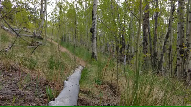
| ThankWhat I rode of this section of the Colorado Trail was a two-way back-country ride on a hiking trail with few technical features although it does twist and turn. Very pleasant forest and back-country feel.
| ThankThe portion of the Colorado Trail between Camp Hale and Copper Mountain is an absolutely fantastic section of the Colorado Trail! The singletrack is ripping, the climbs are tough, and the high alpine riding is unparalleled! My favorite part is getting to traverse between Searle Pass and Kokomo Pass, spending a significant amount of time way above treeline. Highly recommended!
| ThankThe portion of the Colorado Trail between Camp Hale and Copper Mountain is an absolutely fantastic section of the Colorado Trail! The singletrack is ripping, the climbs are tough, and the high alpine riding is unparalleled! My favorite part is getting to traverse between Searle Pass and Kokomo Pass, spending a significant amount of time way above treeline. Highly recommended!
| ThankRode from the top of Monarch Pass and down Fooses. Relatively quick shuttle ride, 15-20 min or so probably. Monarch's a good warmup, and the Fooses downhill is pretty amazing. Steep, loose, rutted drop-in up top (with epic views), and it stays fairly steep for a while on tight, rooty singletrack. Gets picky for a while, then opens up through the forest, extremely fast, great dirt, occasionally very rocky and semi-technical, but mostly just fast and fun.
| ThankThanks Johnnymac. Fred has done the same thing to other highly-rated trails as well--not sure why. Anyway, don't worry--ratings only count once per person.
| ThankSince these guys are trying to ruin this trails rating...
| ThankGood
| ThankBeautiful segment of Colorado Trail. Like most CO trails, this one is the same rocky, steep and breathtaking views 360*.
| ThankTraveled all the way from Norway and did the whole trail last summer with two good friends. Best long distance trail I have ridden, so many good sections, and beautiful scenery! Can not recommend this trail enough!
Check out our video from the trip here:
| Thankhttps://www.youtube.com/watch?v=qeXnLbwwbiU
Epic alpine singletrack with amazing views literally starting right off US 550! This is a popular ride for bikepackers/shuttles, but excellent out and back or loop ride options exist as well. The first 8 miles (starting from Molas Pass) are prime trail with a few small technical sections. You can turn around at this point and still claim a great ride. After that roughly 8 mile mark the trail gets more rocky with some steep sections and really narrow lines. At about this time the altitude really starts to get to you too! (You are over 11,000 feet practically the whole time!) But overall the trail is very doable for the conditioned rider. After about 10 miles, a junction with the Engineer Mountain Trail is reached. Turn left to complete a loop by going down Engineer, turning left onto Pass Creek Trail just shy of 4 miles down (which ends at US 550/Coal Bank Pass), and then riding US 550 back up to Molas Pass. Bear right to continue on the Colorado Trail toward Rolling Mountain Pass at 12,500', and then down and back up to Bolam Pass. It takes quite the physical effort to make it up to Rolling Mountain Pass at this point, but the views make it all worthwhile! (The pass is another great turnaround point.)
This is one trail prone to harsh weather due to the altitude, so an early start is highly recommended. It is barren tundra for the majority of the ride, so not the place to be during a thunderstorm! Be prepared to get muddy after any significant rain due to the many drainages where the trail runs on the side of slopes. This trail does also have a short riding window, I'd say mid-July through September. Be prepared to share the trail with a lot of hikers as well. Overall this is a must do!
| Thank